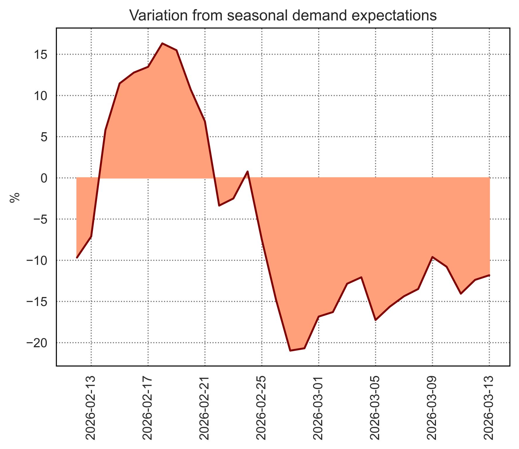
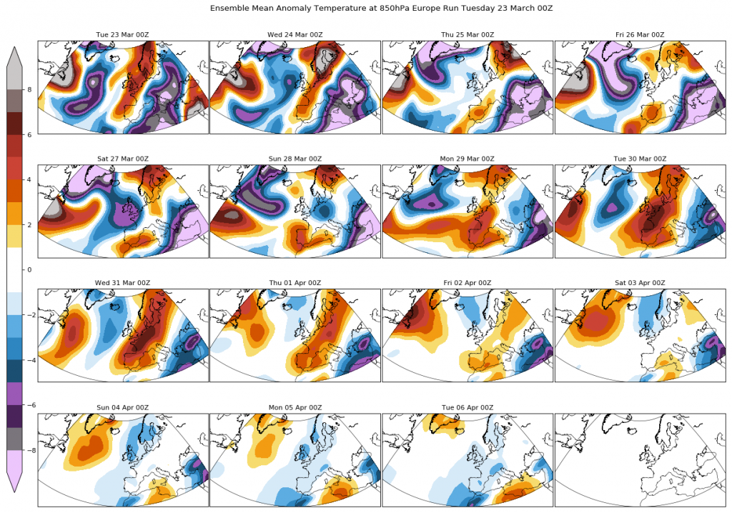
Week 12 – Stable conditions over the entire continent due to the presence of a high pressure centre. Over the weekend an Atlantic front enters from the Atlantic, bringing a short lived cool, wet and windy period over the UK and Western Europe.
Week 13– Week 13 will see two well differentiated phases. It will start with an increase in stability over Southern and Central Europe as high pressure builds up again whilst the north will see a new Atlantic low, bringing wet and windy conditions.
As the week moves on, pressure is expected to gradually decrease over the continent, and increase sharply over the Atlantic, being very likely that a blocking pattern develops west of Azores.
This synoptic situation is very favourable to an increase of instability in Western and Southwest Europe. Therefore we expect, around the change of month, the beginning of a wet period initially majorly affecting Spain and France. Its very likely that wind generation reaches high levels too in those regions..
Rest of April – We expect the Atlantic blocking pattern to become persistent, and therefore we expect an April showing wetter and windier conditions than the climatic average in Southwest and probably West Europe.
In this new update, we expect a predominance of colder than normal conditions mostly everywhere: in Southwest Europe due to the frequent instable periods and in the rest of the continent due to the domain of north-westerly winds.
Source: WeatherTrend
